“Trace” by Alison Sant
Title:
Artist(s) and People Involved:
Exhibiting Artist(s):
Symposium:
Venue(s):
Artist Statement:
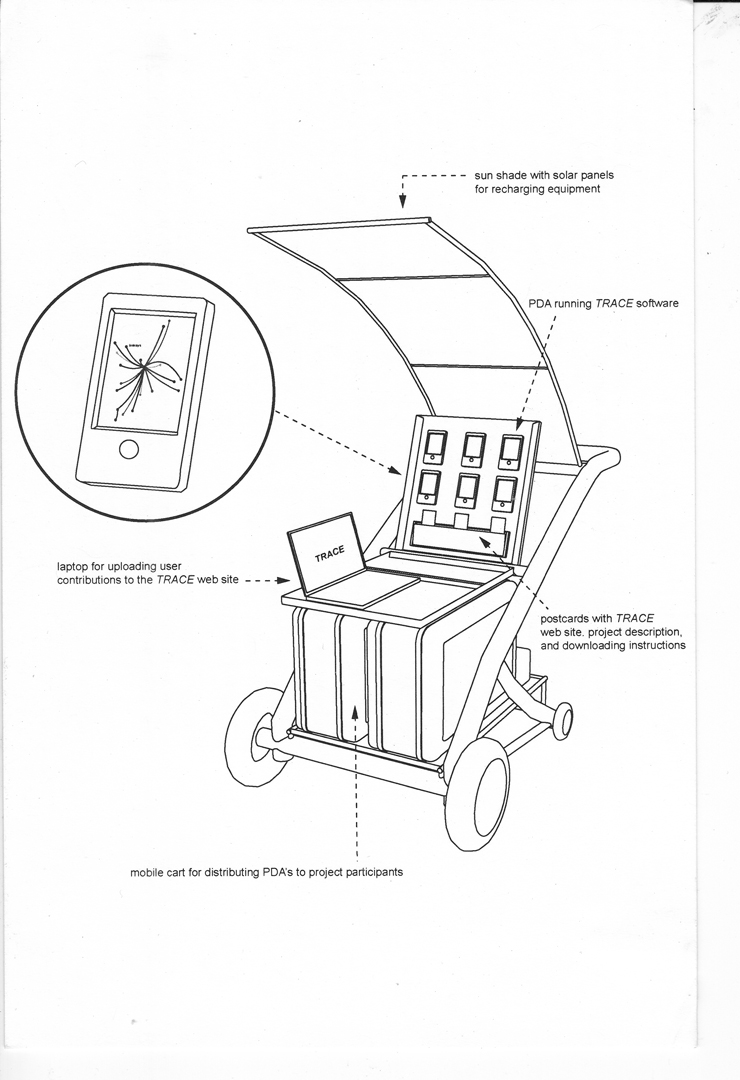
My work tends to focus on the hidden dynamics of the urban landscape http://www.alisant.net. In my most recent project, TRACE http://www.tracemap.net, I have been examining the overlay of wireless networks on urban space and have been particularly interested in the ways in which WiFi networks undermine our conventional understanding of architecture and the city.
Thousands of WiFi hubs are installed in residential and commercial spaces every week, each of which further disintegrates the traditional architectural boundaries between public and private space. A typical WiFi hub may have a signal radius of 150 feet. Some of these hubs extend intentionally and unintentionally into public space, creating an invisible front porch to the houses, apartments and businesses where they are installed. This spatial phenomenon has produced new urban practices in which neighbors or passers-by access unlocked private networks to borrow bandwidth. As private space is extended into the public realm, the margins of the built infrastructure become increasingly eroded by the use patterns that penetrate them.
Our understanding of physical space becomes complicated by traces of electronic signals, the way they are formatted, and the information they project to us. The wireless network suggests a new subtext to urban space. In turn, these transmissions change our fundamental understanding of location. Instead of responding purely to the physical space around us, we also become engaged with the fleeting qualities of wireless signal. I am interested in how the network in turn begins to inform and direct our interactions with the urban landscape, possibly as significantly as the material landmarks on city maps.
Further, as the traditional structures of urban reference are intersected by the dynamics of an unseen landscape, I am interested in how we develop new means of orientation. Urban planner, Michael Batty is especially instructive on this point. In his essay entitled “Thinking About Cities as Spatial Events,” he proposes that “It is possible to conceive of cities as being clusters of ‘spatial events'” He argues for a temporal understanding of the life of the city as a means for appreciating the profound effects of events that take place in cities over short periods of time.
As we chart this emerging landscape I am interested in the ways in which the strategies of mapping can be used to both respond and suggest a notion of urban space in which the temporal life of the city may become more prominent than the static landmarks of the urban grid.


