“Memory of space” by Ursula Damm
Title:
Artist(s) and People Involved:
Exhibiting Artist(s):
-
Ursula Damm
-
- Bauhaus University Weimar
Symposium:
Venue(s):
Medium:
Artist Statement:
This project deals with the discrepancy between an individual’s surroundings in everyday life and the internal “spaces” which he/she imagines and lives out. Its objective is an architecture designed to develop an adaptable mode of building. The point of departure is how human beings move about. Points of reference are then to be derived from easily observed magnitudes; these, in turn, lead to the modelling of characteristics as the result of interaction.
“memory” of space is one stage within the framework of the inoutsite project that depicts space in its temporal alterations and explores how individual experiences of “space” generate into the social construct of city. To what extent is the experience of a public space conditioned by me and my (unique) memory – to what degree conditions it conventions that result from social intercourse with others and with architectonic/geographic realities?
In this case, an ample, much-frequented square is being monitored by a central camera. The video’s signals are passed on to two computers, which edit the video. One of them screens the picture for the movements of people who were crossing, meeting andlor lingering on the square. On the basis of these movement data from the past hours, the other computer calculates a picture describing the qualities of the place.
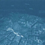
The installation “memory of space” links local and geographic dimensions. An aerial view underlying the virtual scene enables the visual scrutinization of the virtual picture with regard to potential relations to open-plan axes. At the ground of the virtual picture is a grid system of co-ordinates which depending on the place’s usage can be pulled over a selforganizing map (a simple, neuronal net). By doing so, walking speed and direction are applied to the co-ordinates, pushing them into their direction. A videotexture with the videopicture of the tracked place is mapped upon the coordinate system, offering the user references to the real place. On the basis of these inquiries, the monitored place is divided into “territories”: areas of rest and walking lanes. These lanes are inscribed as “network of corridors” (grey lines) on the distorted by the movements) reproduction of the square. In the remaining spaces those places where peoples showed a tendency to dwell (walking speed = 0) were marked red.
Sponsors:
The project has been made possible by the Academy of Media Arts Cologne.
Additional Images:
- 2002 Damm Memory of space


